Κατάλογος εικόνων
Από RemoteSensing Wiki
Αυτή η ειδική σελίδα δείχνει όλα τα ανεβασμένα αρχεία. Τα πιο πρόσφατα είναι στην κορυφή της λίστας.
Πατήστε στην επικεφαλίδα μιας σειράς για αλλάξει η ιεράρχηση.| Όνομα | Χρήστης | Μέγεθος | Περιγραφή | Εκδόσεις | |
|---|---|---|---|---|---|
| 18:52, 29 Μαΐου 2015 | Lava_Dome_2.jpg (αρχείο) | Rs13412 | 113 KB | 1 | |
| 18:43, 29 Μαΐου 2015 | Lava_Dome.jpg (αρχείο) | Rs13412 | 6 KB | 1 | |
| 18:39, 29 Μαΐου 2015 | Frost.gif (αρχείο) | Rs13412 | 180 KB | 1 | |
| 18:16, 29 Μαΐου 2015 | Oasisis.jpg (αρχείο) | Iromp | 143 KB | 1 | |
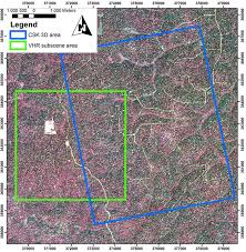
| 17:00, 29 Μαΐου 2015 | Index.jpg (αρχείο) | Rs13553 | 17 KB | 1 | |
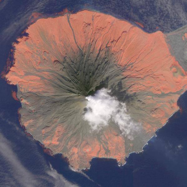
| 16:48, 29 Μαΐου 2015 | Ηφαισ.jpg (αρχείο) | Iromp | 44 KB | 1 | |
| 16:40, 29 Μαΐου 2015 | Plantation.jpg (αρχείο) | Rs13412 | 12 KB | 4 | |
| 16:26, 29 Μαΐου 2015 | Paricutin.jpg (αρχείο) | Iromp | 164 KB | 1 | |
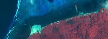
| 16:18, 29 Μαΐου 2015 | Red_tides.jpg (αρχείο) | Rs13412 | 6 KB | 6 | |
| 16:17, 29 Μαΐου 2015 | Red_Tides.jpg (αρχείο) | Rs13412 | 6 KB | 1 | |
| 16:13, 29 Μαΐου 2015 | Gulf_Mexico_oil_spill.jpg (αρχείο) | Rs13553 | 394 KB | (Πετρελαιοκηλίδα, Μεξικό Landsat) | 1 |
| 15:53, 29 Μαΐου 2015 | Red_tide_2.gif (αρχείο) | Rs13412 | 613 KB | 1 | |
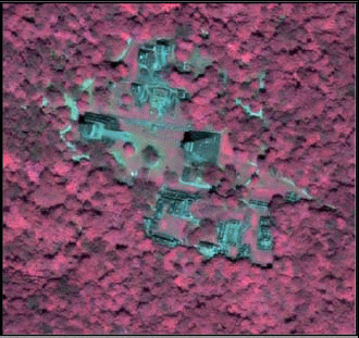
| 13:17, 29 Μαΐου 2015 | Sbsettlement.jpg (αρχείο) | Loukdrummer1932 | 142 KB | (ζούγκλα.Πηγή:http://nsstc.uah.edu/ats/tomsever/proj_peten.html) | 1 |
| 13:02, 29 Μαΐου 2015 | Ikonoseg.gif (αρχείο) | Loukdrummer1932 | 85 KB | (ζούγκλα_στην_περιοχή_του_Αμαζονίου.Εικόνα_από_δορυφόρο_ ikonos.Ημερομηνία_φωτογραφίας:1999.Πηγή:http://nsstc.uah.edu/ats/tomsever/proj_peten.html) | 1 |
| 13:00, 29 Μαΐου 2015 | Cryosphere_ice_shelf_collapse.jpg (αρχείο) | Μελινα Δολαψακη | 764 KB | (Kangerdlugssuaq Glacier, Greenland ) | 2 |
| 12:45, 29 Μαΐου 2015 | Forest_landsat2.jpg (αρχείο) | Catherine | 7 KB | (Credit: NASA image created by Jesse Allen, using Landsat data provided by the University of Maryland’s Global Land Cover Facility. Caption by Michon Scott.Πηγή:http://visibleearth.nasa.gov/view.php?id=8810.) | 1 |
| 12:40, 29 Μαΐου 2015 | Forest_landsat.jpg (αρχείο) | Catherine | 7 KB | (Credit: NASA image created by Jesse Allen, using Landsat data provided by the United States Geological Survey. Caption by Michon Scott.Πηγή:http://visibleearth.nasa.gov/view.php?id=35547.) | 1 |
| 12:30, 29 Μαΐου 2015 | Landsat---Chicago---Glace-et-neige---03-01-2014---1.jpg (αρχείο) | NefeliT | 1,09 MB | (Chicago 3 Ιανουαρίου 2014 LANDASAT ) | 1 |
| 12:21, 29 Μαΐου 2015 | Image_lavalake.jpg (αρχείο) | NefeliT | 331 KB | (Landsat 8 image over Bardarbunga and Hálslon Reservoir. September 6, 2014. (NASA/USGS/Mia Bennett)) | 5 |
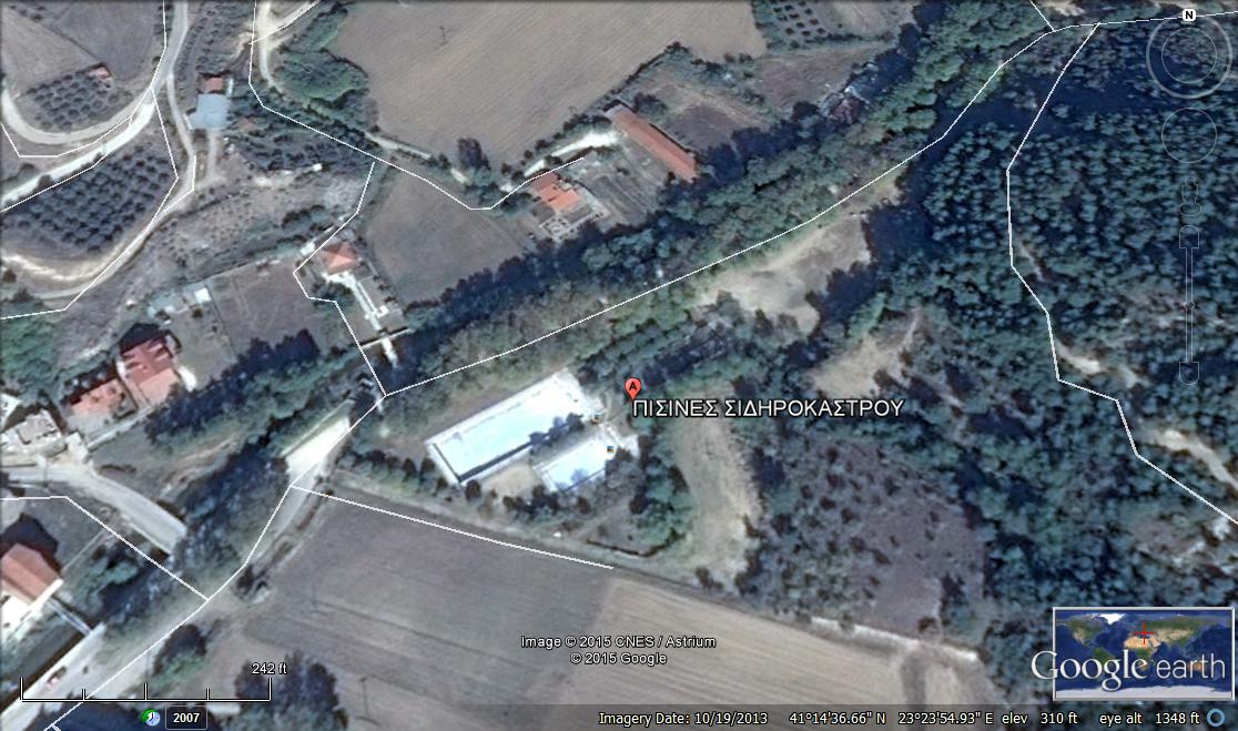
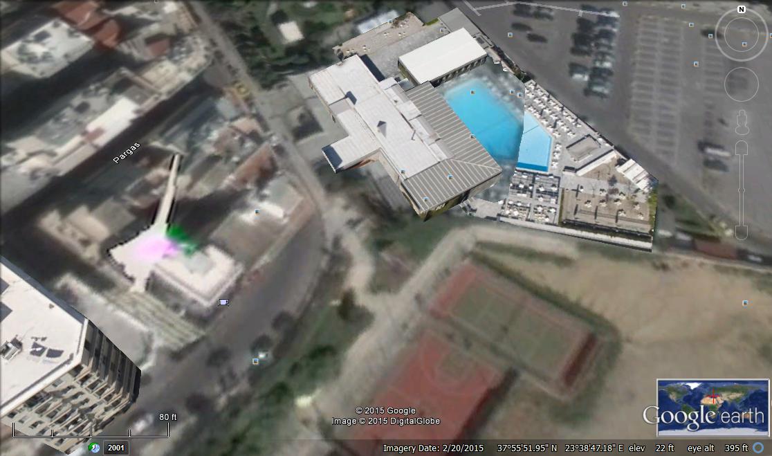
| 12:03, 29 Μαΐου 2015 | Πισινες_2_google_earth.jpg (αρχείο) | Loukdrummer1932 | 142 KB | (πισίνες_στην_περιοχή_σιδηρόκαστρο.Πηγή:google_earth. ) | 1 |
| 12:03, 29 Μαΐου 2015 | Africa_richat_structure_maur_adrar_desert_mauritania_volcanic_dome_landsatwall.jpg (αρχείο) | NefeliT | 228 KB | (africa richat structure volcanic landsat 8 ) | 1 |
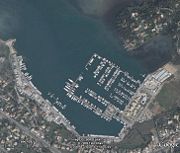
| 12:02, 29 Μαΐου 2015 | Portkerkira.jpg (αρχείο) | Θεοδωρακη Μαριαννα | 8 KB | (Το λιμάνι της Κέρκυρας, με έγχρωμο σύνθετο RGB321 από δορυφόρο QUICKBIRD. Πηγή: Google Earth.) | 1 |
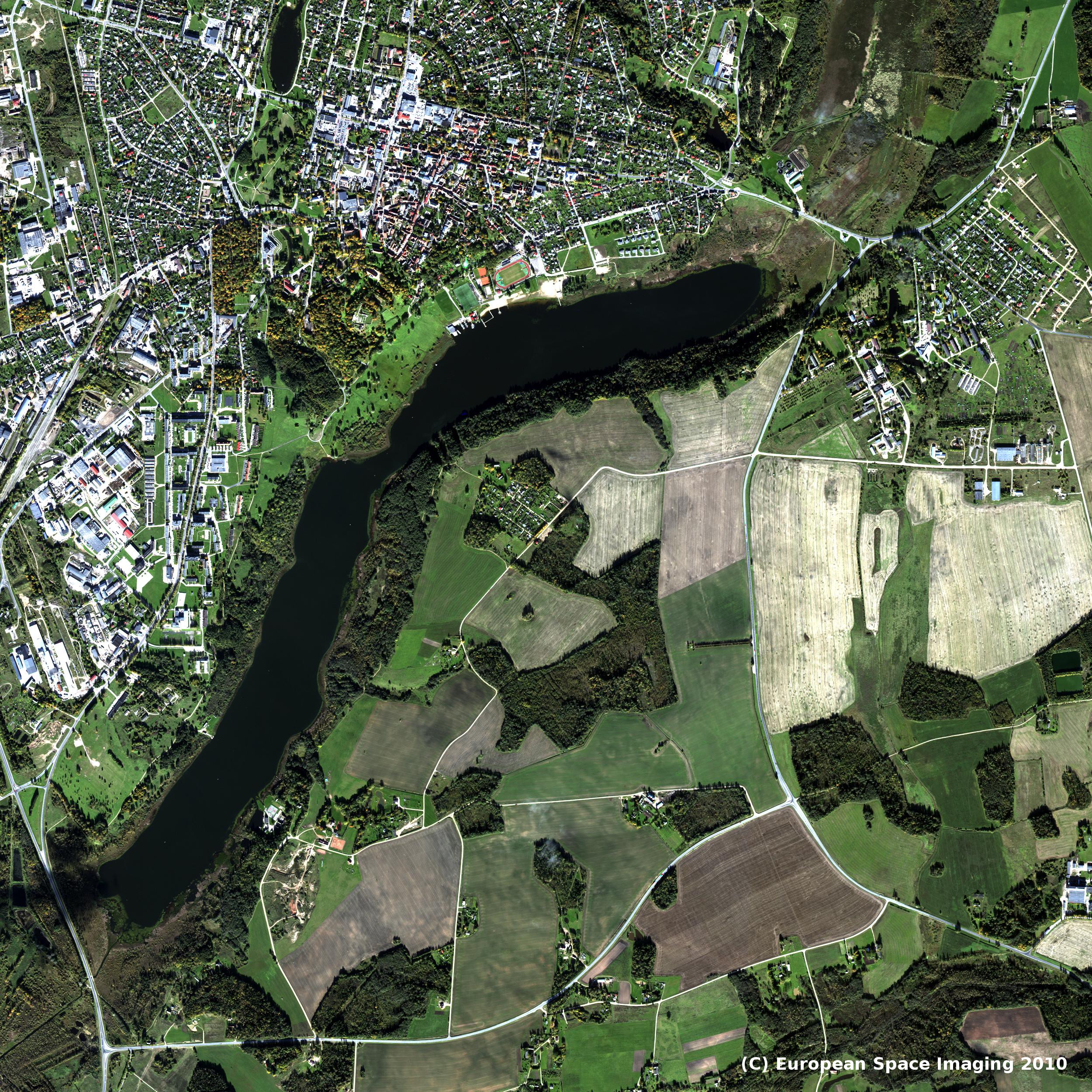
| 11:59, 29 Μαΐου 2015 | 183.Viljandi_full_res_VIS.jpg (αρχείο) | Catherine | 1,99 MB | ( Lake Viljandi and its surroundings in October 2010 on a WorldView-2 infrared image.Picture from Quickbird.Πηγή:http://www.regio.ee/?op=body&id=239.) | 1 |
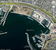
| 11:51, 29 Μαΐου 2015 | Portpeiraias.jpg (αρχείο) | Θεοδωρακη Μαριαννα | 10 KB | (Λιμάνι του Πειραιά. Δορυφόρος QUICKBIRD με έγχρωμο σύνθετο RGB321. Πηγή Google Earth) | 1 |
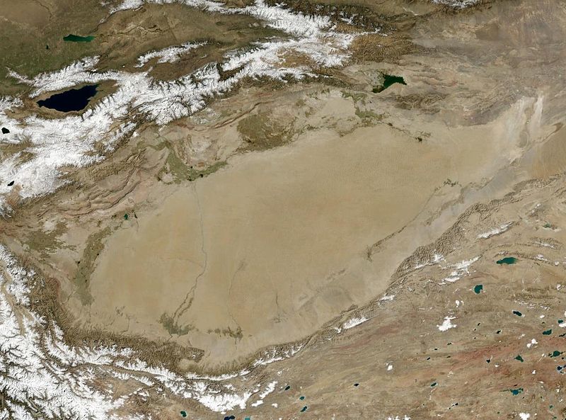
| 11:40, 29 Μαΐου 2015 | 800px-Wfm_tarim_basin.jpg (αρχείο) | Eleni Sofikiti | 118 KB | (Tarim Basin, Asia Unknown date NASA Landsat) | 1 |
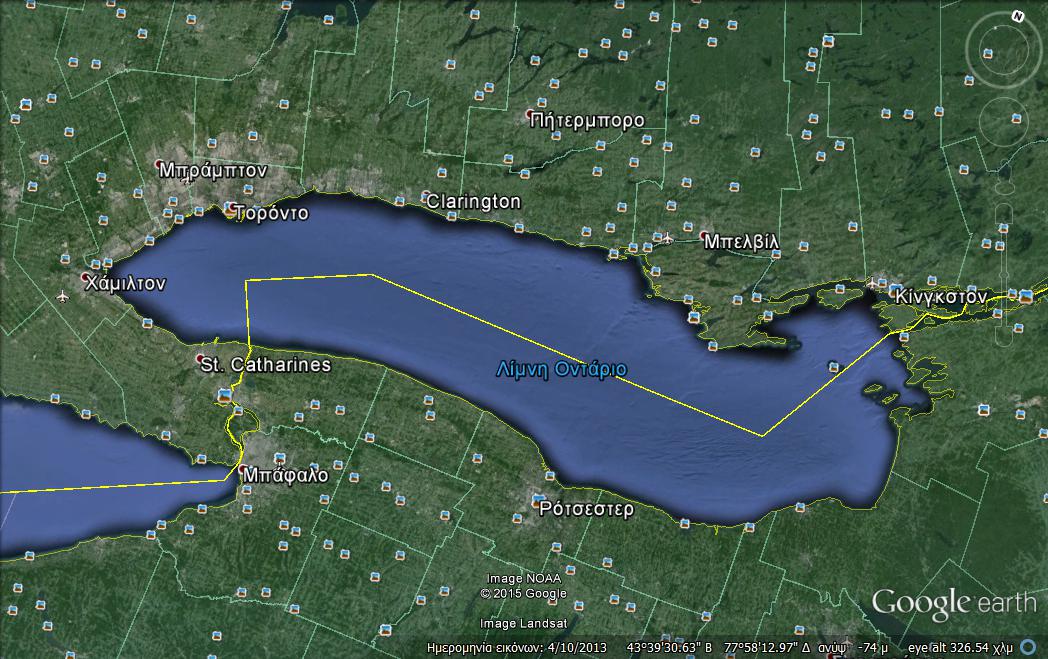
| 11:39, 29 Μαΐου 2015 | Λίμνη_Οντάριο.jpg (αρχείο) | Catherine | 145 KB | (Λίμνη_Οντάριο_στο_Τορόντο_στην_Αμερική.Πηγή:google_earth.) | 1 |
| 11:38, 29 Μαΐου 2015 | Pisines_google_earth.jpg (αρχείο) | Loukdrummer1932 | 94 KB | (Ιδιωτική_πισίνα_στην_περιοχή_πασαλιμάνι_του_πειραιά.Πηγή:google_earth.) | 1 |
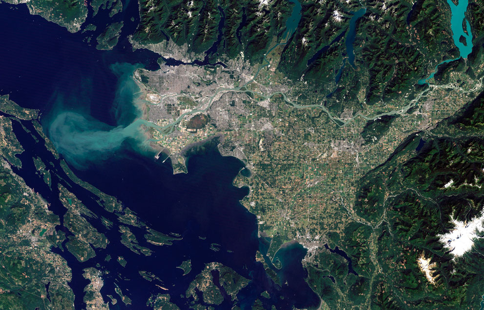
| 11:37, 29 Μαΐου 2015 | S_e28_52011250.jpg (αρχείο) | Γεωργια Ηλιοπουλου | 249 KB | (The Thematic Mapper on NASA's Landsat 5 satellite captured this image of Vancouver, British Columbia, on September 7, 2011. Flowing through braided channels, the Fraser River meanders toward the sea, emptying through multiple outlets. (NASA Earth Observat) | 1 |
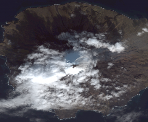
| 11:32, 29 Μαΐου 2015 | Scientistsmo.png (αρχείο) | Eleni Sofikiti | 389 KB | (Cleveland Volcano Quickbird-2 October 15, 2011 Image Copyright: Digital Globe, 2012) | 1 |
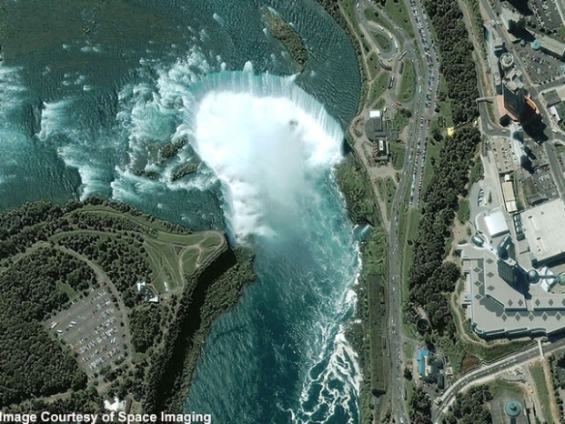
| 11:03, 29 Μαΐου 2015 | Sat01.jpg (αρχείο) | Anastasiou Anastasia | 289 KB | (Niagara Falls (United States) Quickbird August 2, 2004 source: http://navyfoundationkeralacharter.in/) | 1 |
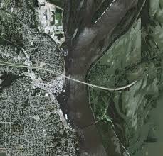
| 10:49, 29 Μαΐου 2015 | Gulfport_iko_2008172_lrg.jpg (αρχείο) | Anastasiou Anastasia | 11 KB | (Mississippi River Floods Gulfport, Illinois Ikonos June 2003 source: http://visibleearth.nasa.gov/) | 1 |
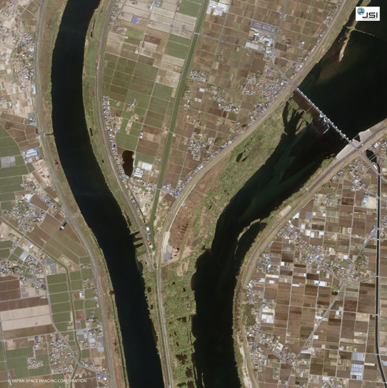
| 10:41, 29 Μαΐου 2015 | Ikonos_03.jpg (αρχείο) | Anastasiou Anastasia | 304 KB | (Nagaragawa River /Kisogawa River (Japan) Ikonos April 24, 2004 source: http://www.pasco.co.jp/) | 1 |
| 10:24, 29 Μαΐου 2015 | Wallops_oli_2014123.jpg (αρχείο) | Melpomeni Petrou | 245 KB | (Virginia’s Eastern Shore May 3, 2014. Landsat 8 source: NASA’s Earth Observatory, http://earthobservatory.nasa.gov/) | 1 |
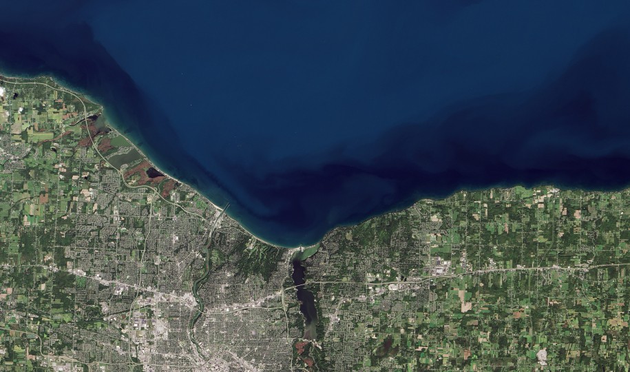
| 10:19, 29 Μαΐου 2015 | Lake-ontario_southern-shore_landsat8_nasa-915x540.jpg (αρχείο) | Melpomeni Petrou | 150 KB | (Southern Shore of Lake Ontario (near New York) Landsat 8 September 19, 2013 source: Operational Land Imager (OLI)) | 1 |
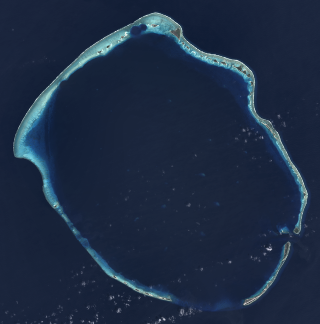
| 10:08, 29 Μαΐου 2015 | Enewetak_Atoll_-_2014-02-10_-_Landsat_8_-_15m.png (αρχείο) | Melpomeni Petrou | 408 KB | (Enewetak Atoll (Marshall islands) Landsat 8 satellite source: http://www.wikiwand.com/) | 1 |
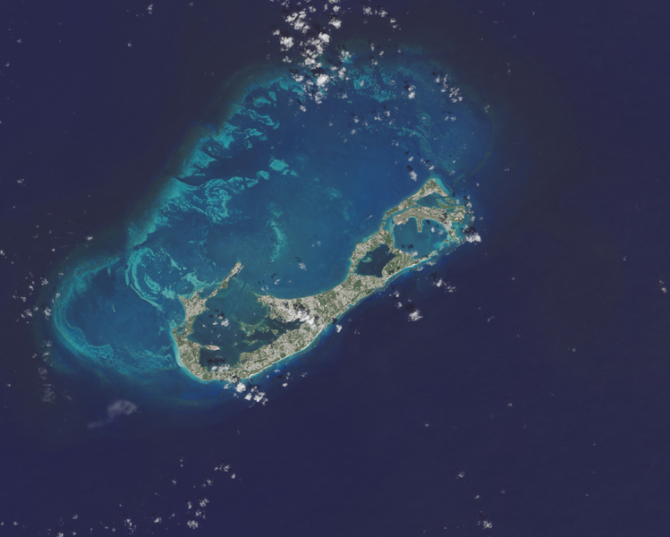
| 10:03, 29 Μαΐου 2015 | Bermuda_oli_2014275_lrg-cropped.png (αρχείο) | Melpomeni Petrou | 516 KB | (Bermuda seen by the Operational Land Imager on the Landsat 8 satellite. 2 October 2014 source: http://earthobservatory.nasa.gov/IOTD/view.php?id=84595) | 1 |
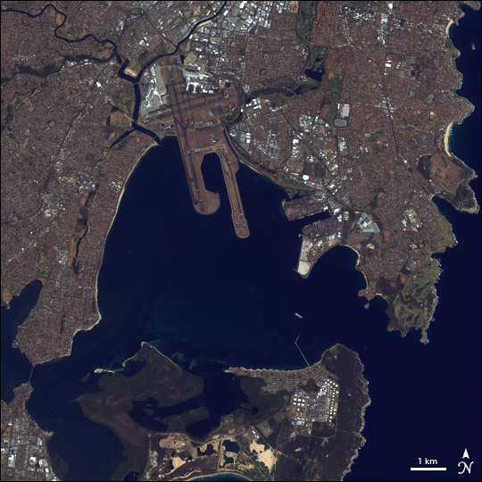
| 20:10, 28 Μαΐου 2015 | Rs13605_wiki_port_botany_australia.jpg (αρχείο) | Rs13605 | 100 KB | (Λιμάνι Botany στο Σίδνευ της Αυστραλίας) | 1 |
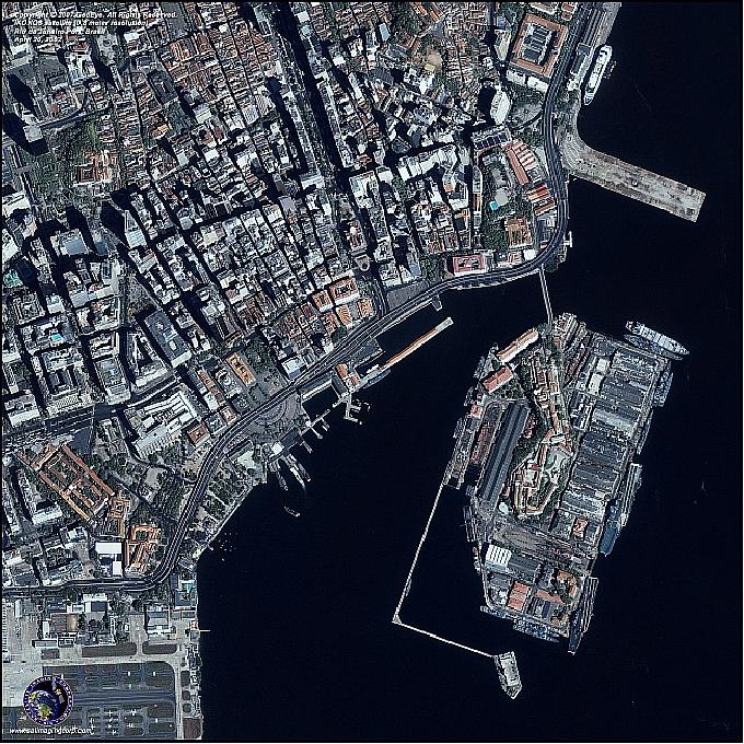
| 19:53, 28 Μαΐου 2015 | Rs13605_wiki_port_of_rio_de_janeiro.jpg (αρχείο) | Rs13605 | 171 KB | (Λιμάνι του Rio de Janeiro, 20 Απριλίου 2002) | 1 |
| 11:10, 28 Μαΐου 2015 | 278602AB00000578-3036861-Linear_dunes_like_these_captured_by_Nasa_s_Landsat_7_satellie_ar-a-33_1428926794273.jpg (αρχείο) | Rs13605 | 337 KB | ("Rainobow" linear sand dunes in the Saharan desert as the sun sets on, creating stripes of light and shadow. Captured by Landsat 7.) | 1 |
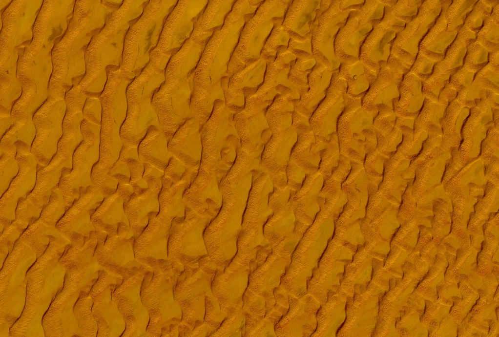
| 10:49, 28 Μαΐου 2015 | Rs13605_wiki_Taklamakan_desert_sand_dunes_landsat_7.png (αρχείο) | Rs13605 | 1,21 MB | (Aμμόλοφοι στην έρημο Taklamakan. Εικόνα από δορυφόρο Landsat.) | 1 |
| 09:09, 28 Μαΐου 2015 | Α5.jpg (αρχείο) | Limberi Sofia | 80 KB | 1 | |
| 09:08, 28 Μαΐου 2015 | Α4.jpg (αρχείο) | Limberi Sofia | 42 KB | 1 | |
| 09:08, 28 Μαΐου 2015 | Α3.jpg (αρχείο) | Limberi Sofia | 53 KB | 1 | |
| 09:07, 28 Μαΐου 2015 | Α2.jpg (αρχείο) | Limberi Sofia | 60 KB | 1 | |
| 08:26, 28 Μαΐου 2015 | Α1.jpg (αρχείο) | Limberi Sofia | 67 KB | 1 | |
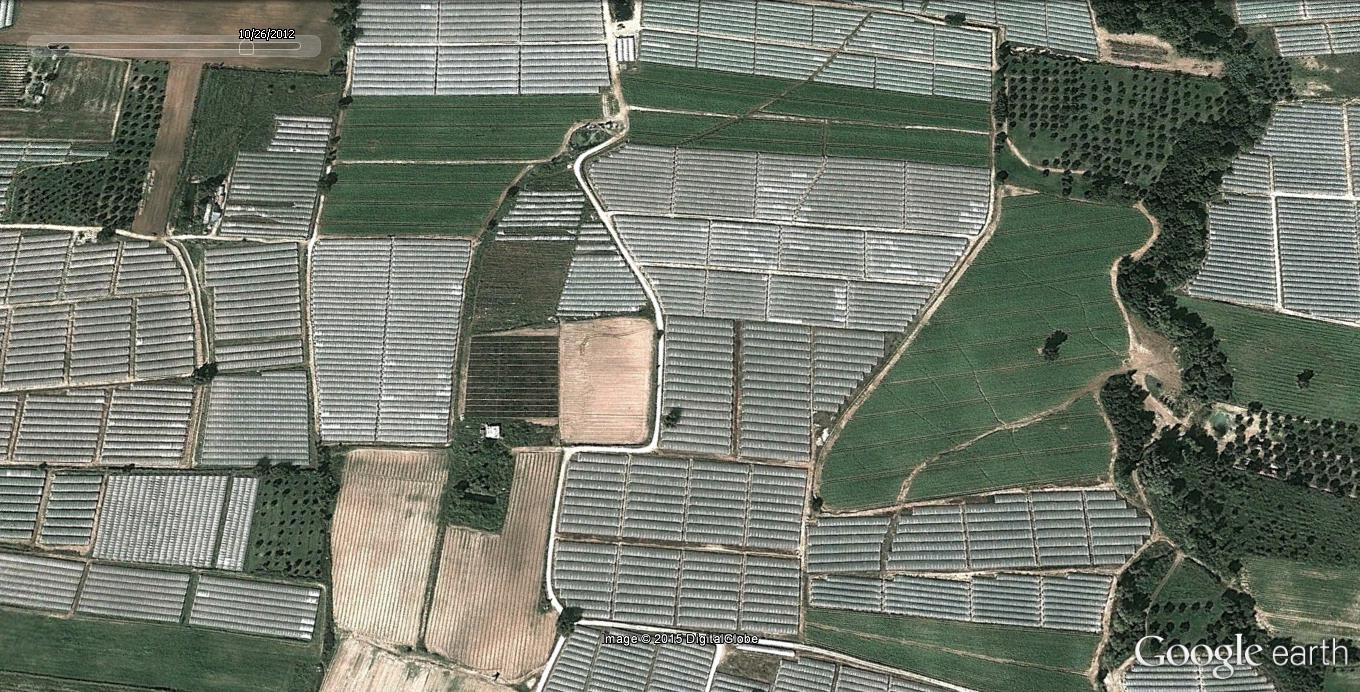
| 21:04, 27 Μαΐου 2015 | Dromos10_26_2012.jpg (αρχείο) | Dimkar | 268 KB | (Εικόνα 5: Έγχρωμο σύνθετο RGB-321 του Quickbird στο οποίο απεικονίζεται ένας δρόμος την περίοδο του Οκτωβρίου. Πηγή:Google Earth) | 1 |
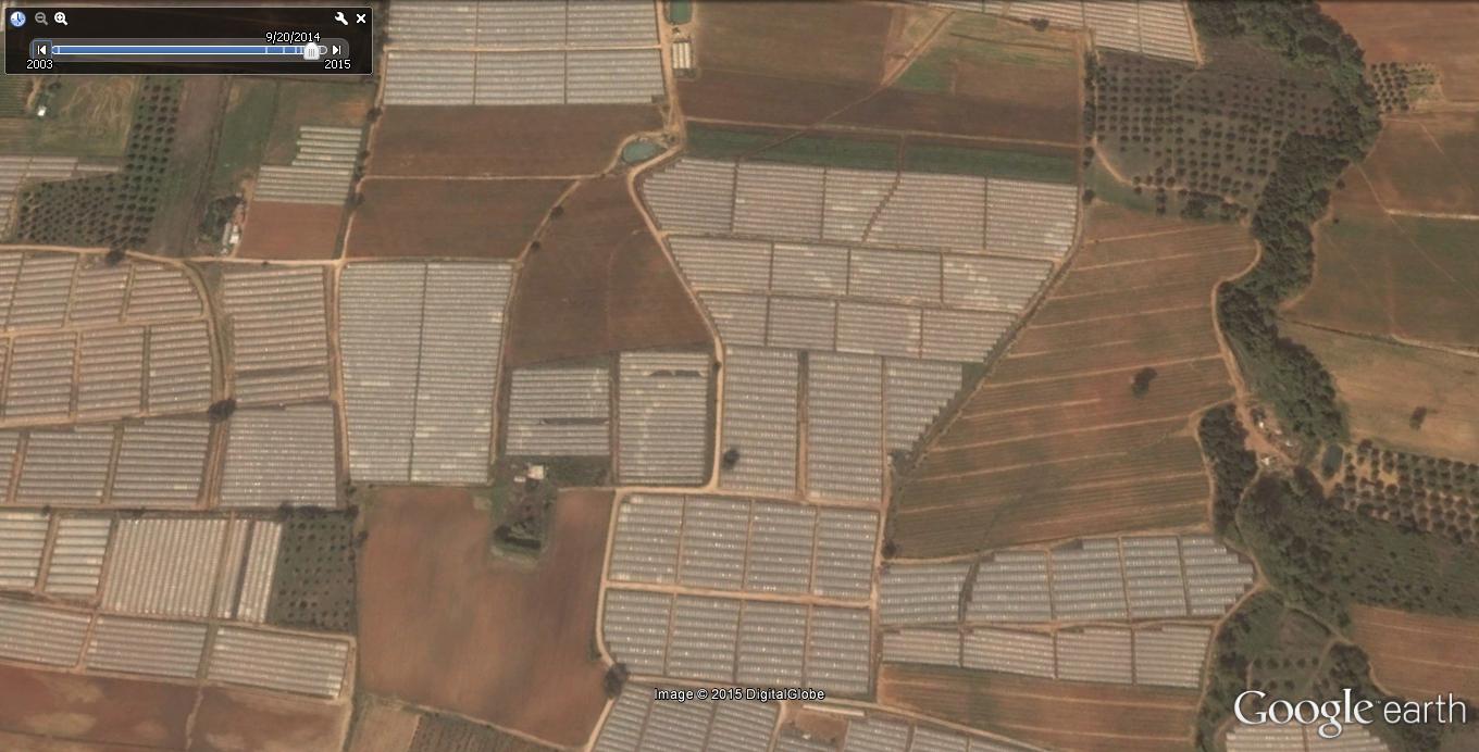
| 21:03, 27 Μαΐου 2015 | Dromos9_20_2014.jpg (αρχείο) | Dimkar | 119 KB | (Εικόνα 4: Έγχρωμο σύνθετο RGB-321 του Quickbird στο οποίο απεικονίζεται ένας δρόμος την περίοδο του Σεπτεμβρίου. Πηγή:Google Earth) | 1 |
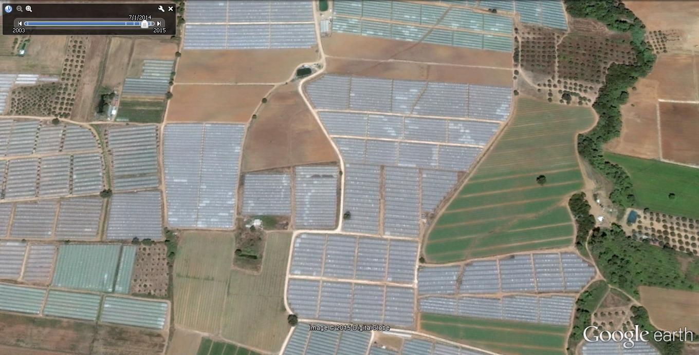
| 21:01, 27 Μαΐου 2015 | Dromos7_1_2014.jpg (αρχείο) | Dimkar | 134 KB | (Εικόνα 3: Έγχρωμο σύνθετο RGB-321 του Quickbird στο οποίο απεικονίζεται ένας δρόμος την περίοδο του Ιουλίου. Πηγή:Google Earth) | 1 |
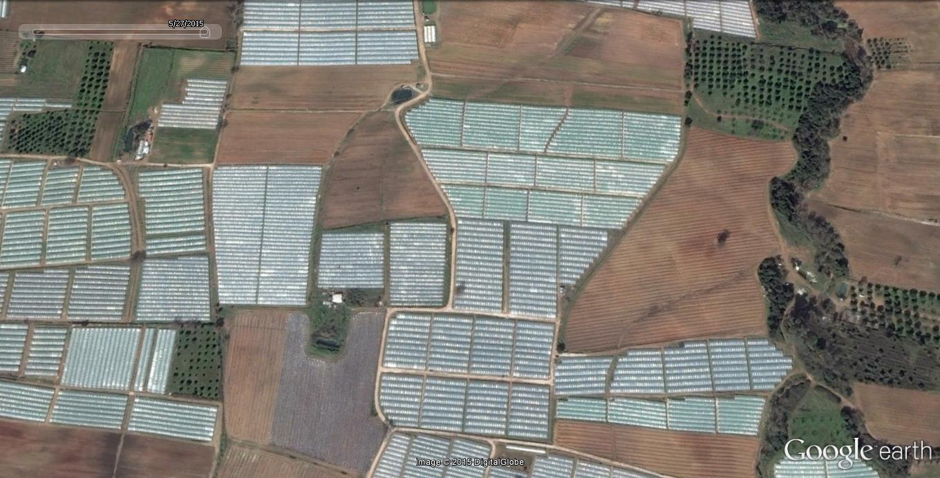
| 21:00, 27 Μαΐου 2015 | Dromos5_27_2015.jpg (αρχείο) | Dimkar | 166 KB | (Εικόνα 2: Έγχρωμο σύνθετο RGB-321 του Quickbird στο οποίο απεικονίζεται ένας δρόμος την περίοδο του Μαΐου. Πηγή:Google Earth) | 1 |
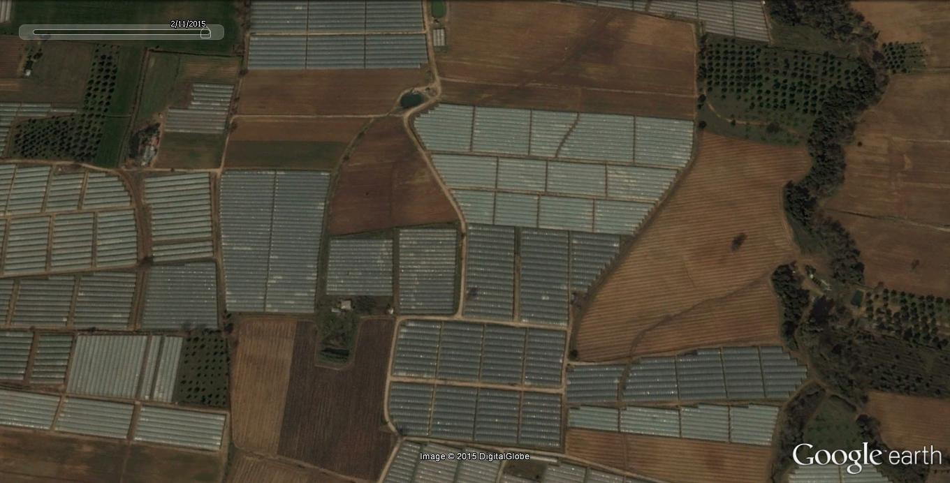
| 20:57, 27 Μαΐου 2015 | Dromos11_02_2015.jpg (αρχείο) | Dimkar | 114 KB | (Εικόνα 1: Έγχρωμο σύνθετο RGB-321 του Quickbird στο οποίο απεικονίζεται ένας δρόμος την περίοδο του Φεβρουαρίου. Πηγή:Google Earth) | 1 |
Πρώτη σελίδα |
Προηγούμενη σελίδα |
Επόμενη σελίδα |
Τελευταία σελίδα |