Αρχείο:S e28 52011250.jpg
Από RemoteSensing Wiki
Μέγεθος αυτής της προεπισκόπησης: 800 × 513 εικονοστοιχεία
Πλήρης ανάλυση (991 × 636 εικονοστοιχεία, μέγεθος αρχείου: 249 KB, τύπος MIME: image/jpeg)
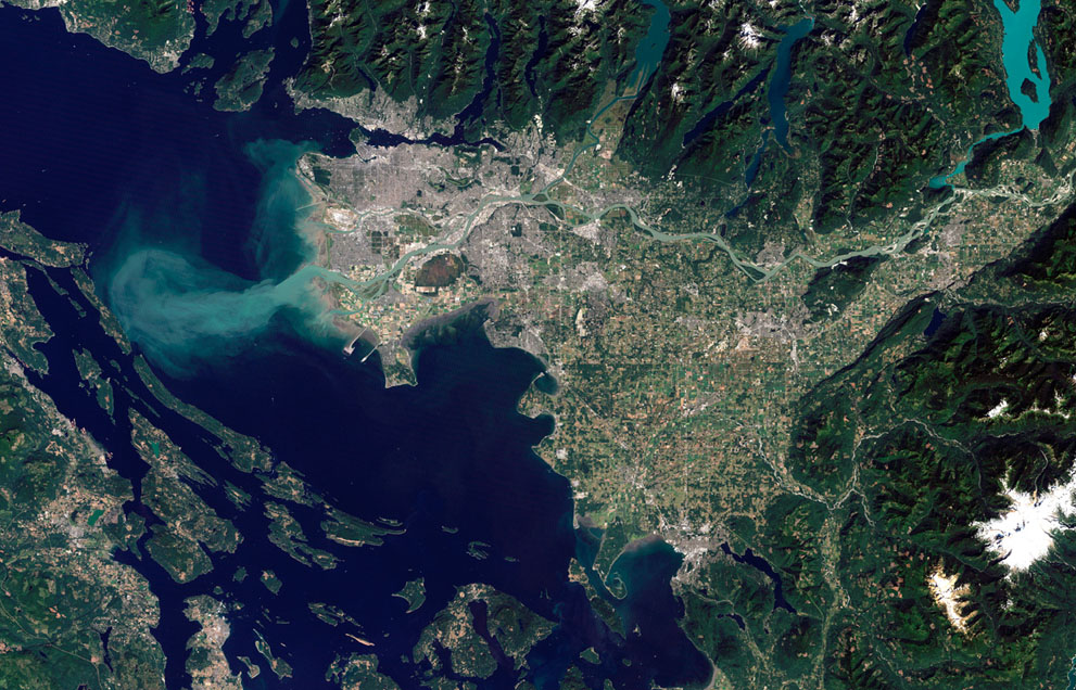
The Thematic Mapper on NASA's Landsat 5 satellite captured this image of Vancouver, British Columbia, on September 7, 2011. Flowing through braided channels, the Fraser River meanders toward the sea, emptying through multiple outlets. (NASA Earth Observatory image created by Robert Simmon and Jesse Alle)
Ιστορικό αρχείου
Πατήστε σε μια ημερομηνία/ώρα για να δείτε το αρχείο όπως εμφανιζόταν εκείνη την ώρα.
| Ώρα/Ημερομ. | Εικονίδιο | Διαστάσεις | Χρήστης | Σχόλια | |
|---|---|---|---|---|---|
| τελευταία | 11:37, 29 Μαΐου 2015 | | 991×636 (249 KB) | Γεωργια Ηλιοπουλου (Συζήτηση | Συνεισφορές/Προσθήκες) | (The Thematic Mapper on NASA's Landsat 5 satellite captured this image of Vancouver, British Columbia, on September 7, 2011. Flowing through braided channels, the Fraser River meanders toward the sea, emptying through multiple outlets. (NASA Earth Observat) |
- Επεξεργαστείτε το συγκεκριμένο αρχείο χρησιμοποιώντας μια από τις εξωτερικές εφαρμογές. Για περισσότερες πληροφορίες δείτε τις οδηγίες εγκατάστασης.
Συνδέσεις αρχείου
Δεν υπάρχουν σελίδες που συνδέονται με αυτήν την εικόνα.